Automapki versions

Add satellite imagery to AutoCAD, ZWCAD, and BricsCAD base DWG editors
1.9
1.8
Oct 25, 2022
1.3
Jul 13, 2013

Alternative downloads

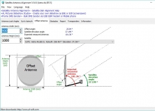
Satellite Antenna Alignment
Free
rating

Calculate the angles necessary for installing satellite dishes.

Karnaugh Map Minimizer
Free
rating

Program designed to minimize the Boolean functions.

Any DWG to PDF Converter Pro
rating

It's a batch converter that allows you to convert DWG to PDF.

Outdoor Map Navigator
Free
rating

OMN lets you plot routes on your PC and sync them with Anquet Cloud.

Map Export
Map Export
rating

Tool for downloading and exporting background image.